Ensuring indoor map quality
The foundation of indoor GIS is the visual representation of indoor environments and spatial data through indoor maps. To create indoor maps with ArcGIS Indoors, you can use multiple data sources, such as computer-aided design (CAD) files, building information modeling (BIM) files, PDF files, and even site scans that capture LiDAR or 3D meshes of building interiors.
As with any project, data quality is key when implementing indoor GIS, so keeping floor plan data accurate, complete, and up-to-date is paramount.
One way to ensure this is to have source data, such as a CAD or BIM file, as the authoritative source for your floor plan lines and then perform an update load of this source data into the geodatabase every time changes are made.
But what happens when the turnaround time to get updates from CAD or BIM and load them into the geodatabase doesn't meet the timeline of your business needs for the data?
Easier and faster floorplan editing
To address this issue, ArcGIS Indoors provides a new web-based, map-centric application for creating and modifying floor plan data, with a key benefit being a user-friendly experience that gives operations staff direct control over managing and maintaining floor plan data outside of ArcGIS Pro.
The new application is called Floor Plan Editor and will be released in beta this July.

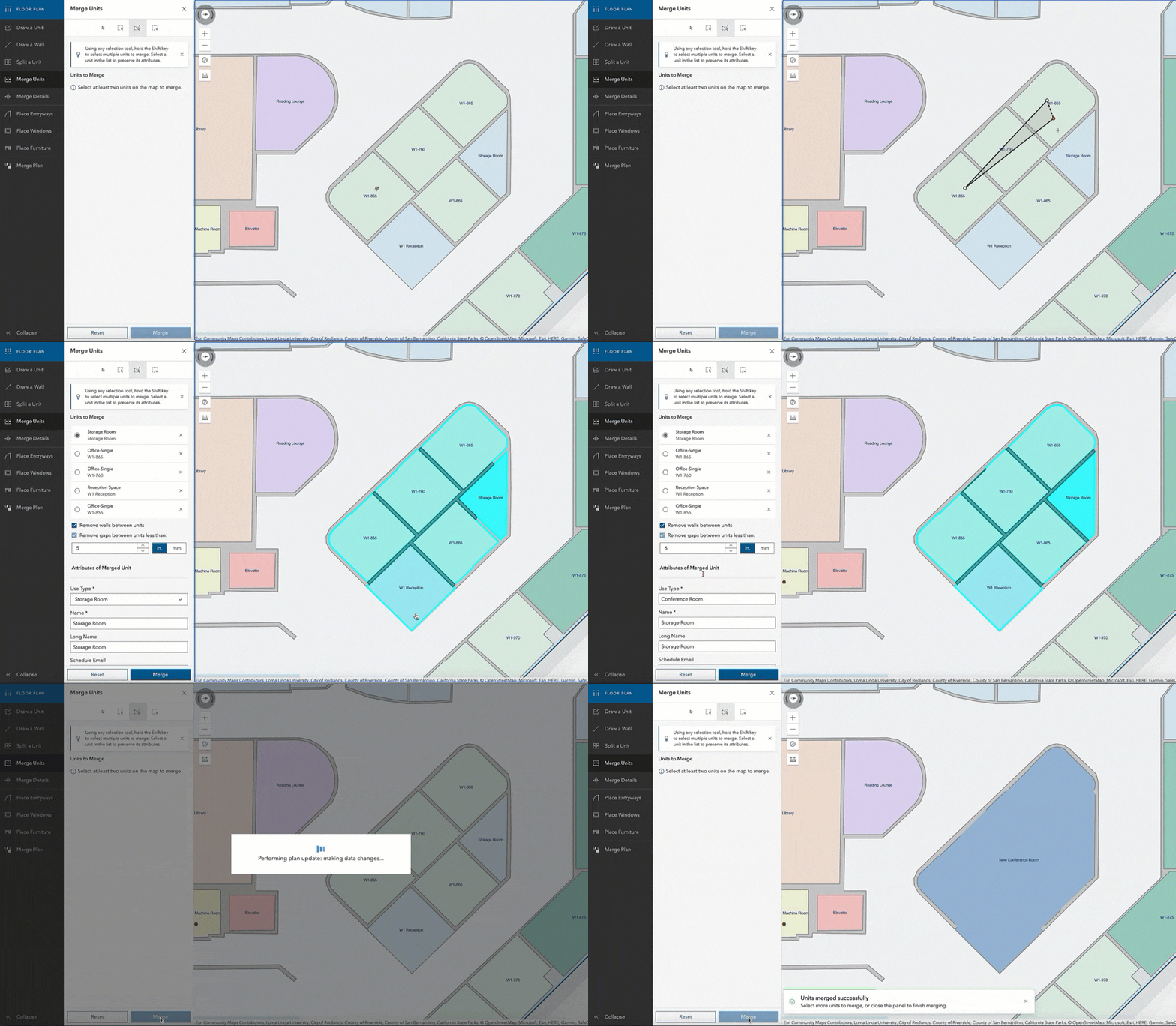
Combine units with our web-based floor plan editor
Operations and facilities staff need an intuitive user experience to modify floor plan layout data. They should be able to:
Create and maintain floor plan data where digital source data does not exist. Maintain floor plans imported from source data that does not update, such as on-site scans of buildings. Modify or update floor plan data that cannot wait for upstream source data, such as CAD or BIM, to be modified and reloaded. Perform what-if scenario planning for floor plan layout changes.
The Floor Plan Editor is designed with these needs in mind. Its features include:
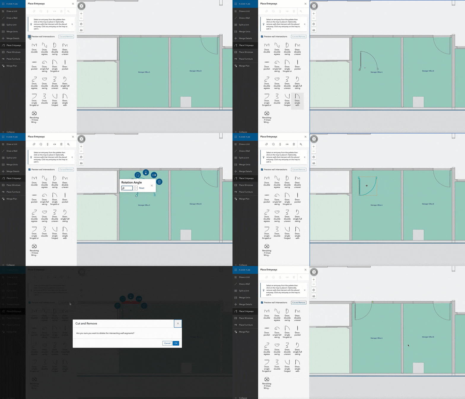
Digitize new spaces (units), floors (levels), and facilities (buildings). Divide, combine, reshape, and attribute spaces. Place doorways, windows, and furniture from the drawing palette. Copy and paste floor plan elements to create new ones from existing ones. * Snapping and distance measurement while digitizing. * Delete, rotate, move, and annotate features.
more.
*These features will be included in the next release of the Beta.

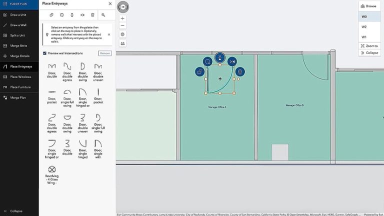
Selection and placement of new entrances and exits within the unit
Additionally, GIS managers can enable stakeholders to edit floor plan data while retaining the ability to load floor plan data updates from CAD and BIM files. The ETL (Extract, Transform, Load) tools provided in the Indoors extension to ArcGIS Pro (ArcGIS Indoors Pro) have been enhanced to provide more flexibility in loading data updates from changes in CAD and BIM files. ArcGIS Pro users can selectively load portions of floor plans, thereby respecting floor plan updates made by business stakeholders in the Floor Plan Editor.
Don't just take our word for it, see for yourself: Sign up now for our Early Adopter Program to gain early access and provide your feedback to help guide the development of Floor Plan Editor.
Enroll in the Early Adopter Program
About the Author

Gaurav Jobanputra
Gaurav Jobanputra is a Principal Product Engineer for ArcGIS Indoors and the product owner for Indoors web and mobile apps. He also works on Indoors apps integration with Indoor Positioning Systems (IPS), Workspace Booking Systems, Work Order Management Systems, and other Esri mobile apps such as FieldMaps and Survey123.
Sylvia Pichler
Silvia is a Senior Product Marketing Manager for ArcGIS Indoors, ArcGIS IPS, and ArcGIS Data Reviewer at Esri. Her mission is to raise awareness about the ever-increasing adoption of GIS in indoor spaces and the importance of data quality.

